Mapping The World
Nowadays, it’s easy to take digital maps for granted; we can easily pull out our phones to find directions and get suggested travelling routes. However, many centuries ago, maps did not exist and our perceptions of the world were very different. The art of mapping, or cartography, has revolutionised our understanding of our planet, but even with high precision mapping and digital technology, maps are always being updated. “Sandy Island”, which was known to be in the South Pacific, for example, was included in maps for over 200 years, but in 2012 scientists proved it didn’t exist when the island couldn’t actually be located.
Historical Beginnings
While evidence of the earliest maps created are contested, from mammoth tooth inscriptions to cave art star maps, Babylonian maps created in 600 BC on clay tablets are generally accepted as the first real global scale maps. Early maps such as these were based more on speculation than scientific approach and had no measure of scale, depicting the Earth as a flat disc. The first scientific approach to cartography was made by Greek astronomer and mathematician Claudius Ptolemy in the 2nd century AD. Through his work on horoscopes, Ptolemy devised a system of longitude and latitude to accurately plot global locations and create a two-dimensional map of the world – which was now known to be round.
The Age Of Exploration
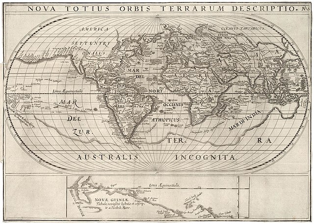
The 15th and 16th centuries marked a pivotal era in the history of mapping. Explorers such as Christopher Columbus, Vasco da Gama and Ferdinand Magellan, through desire for trade and conquest, discovered new lands such as the Americas and new sea routes. New maps were needed to showcase nautical routes with greater accuracy. Much of the inland of these newly found continents was still speculated at the time, however (See the largely absent North America on the map above, which was drawn up around 1621).
The Mercator projection, developed by Gerardus Mercator in 1569, further revolutionised nautical navigation through the ability to represent lines of constant course as straight lines. The mathematical method of the map’s construction caused land masses appear further away from the equator and become distorted and disproportionally larger. This made its practical usage limited but it was ideal for nautical navigation.
Scientific Revolution
During the 17th and 18th centuries, scientific advancements brought about more precise methods for mapping. The invention of the chronometer by John Harrison allowed mariners to finally measure their longitude wherever they were at sea, improving sea navigation. Mapping agencies began to appear along with large scale surveys. In 1745, The Ordinance Survey first started mapping the UK, initially as part of a military defence strategy, bringing with it a higher level of detail than previously seen.
The Digital Revolution Of Mapping
The 20th century has brought with it new technology such as the internet, satellites and geographic information systems (GIS). These advances have allowed the rapid development of highly sophisticated digital maps, through the use of aerial mapping, spatial awareness and data sharing. Companies such as Google have completely revolutionised modern maps, allowing for a higher level of detail and interactivity.
Modern Advantages
While historically maps have served the purpose of navigation, territory marking, trade routes and military campaigns, modern maps are able to provide high-level advantages. GIS technology has allowed scientists to map the spread of diseases, climate change, migration patterns and land development.
This additional level of spatial data has also allowed informed decisions to be made on resource management and urban development. Businesses can analyse customer location data while emergency responders can use GPS locations to rapidly locate accident scenes. Future developments such in AI and real-time dynamics will continue to make our maps more interactive and integrated into our everyday lives.
If you are interested in studying History, Oxford Open Learning offers you the chance to do so at IGCSE and A level, as linked below. You can also Contact Us for more information.

Gavin Crewe is a regular contributor of informative articles to Oxford Home Schooling.