Mapping Mars
Charting The Red Planet’s Terrain And Potential For Exploration
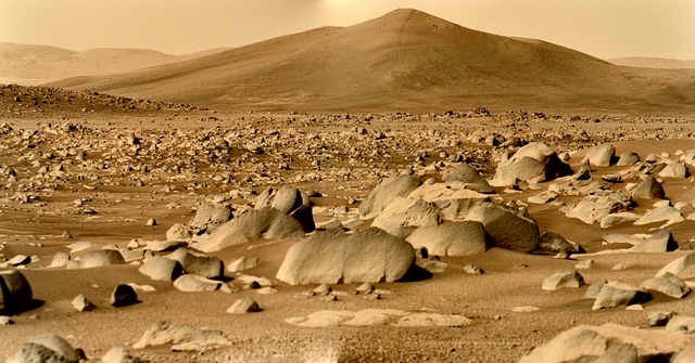
The allure of Mars has captivated the imagination of scientists and space enthusiasts for generations. As we set our sights on exploring the mysteries of the Red Planet, one of the first steps is to meticulously map its terrain and understand its unique characteristics. This process of mapping Mars not only provides valuable insights into its geological features but also unveils the potential for future exploration and the possibility of sustaining human life beyond Earth.
Above And Below
The Mapping of Mars is an intricate task that requires a combination of cutting-edge technology, scientific expertise, and meticulous data analysis. Through the use of satellites, orbiters, and rovers, scientists have been able to capture detailed images and collect data about Mars’ surface, topography, and atmospheric conditions. This data is then transformed into intricate maps which provide a comprehensive view of the planet’s diverse landscapes, from towering volcanoes and deep canyons to ancient riverbeds and polar ice caps.
Facts For The Future
The information derived from these maps serves as a treasure trove for scientists and engineers planning future missions to Mars. By understanding the terrain and composition of the planet, they can identify potential landing sites for spacecraft and rovers, avoiding hazardous areas and maximizing the chances of mission success. Furthermore, these maps aid in the selection of regions that hold the most promise for scientific exploration, such as sites with evidence of past water activity or locations where signs of microbial life may be found.
Mapping Mars also plays a crucial role in determining the planet’s potential for sustaining human life. By studying the distribution of resources, such as water ice deposits and mineral resources, scientists can assess the feasibility of extracting and utilizing these resources for future human missions. Additionally, mapping Mars’ atmospheric conditions and weather patterns allows us to better understand the challenges that would be faced by astronauts on the planet’s surface, including radiation exposure, extreme temperatures, and dust storms.
Mars And Evolutionary Understanding
Moreover, mapping Mars contributes to our broader understanding of planetary formation and evolution. By studying the geological features and mapping the history of the planet’s surface, scientists can gain insights into the its past climate, the possibility of ancient water systems, and the potential for habitability. These findings not only deepen our understanding of Mars but also shed light on the broader questions about the origins of our own solar system and the potential for life beyond Earth.
In conclusion, mapping is an essential endeavour in our quest to explore the Red Planet. It provides a detailed view of its terrain, uncovers potential landing sites, and guides future scientific missions. Furthermore, these maps offer insights into the planet’s resources and its potential for sustaining human life. By mapping Mars, we are not only expanding our knowledge of this captivating world but also paving the way for future exploration and the possibility of a human presence on another celestial body.
